


Algonquin 57 Voting District, McHenry County, Illinois
About
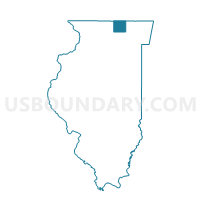
Outline

Summary
| Unique Area Identifier | 572851 |
| Name | Algonquin 57 Voting District |
| County | McHenry County |
| State | Illinois |
| Area (square miles) | 0.50 |
| Land Area (square miles) | 0.49 |
| Water Area (square miles) | 0.01 |
| % of Land Area | 98.02 |
| % of Water Area | 1.98 |
| Latitude of the Internal Point | 42.18607910 |
| Longtitude of the Internal Point | -88.34499660 |
Maps


Graphs
Select a template below for downloading or customizing gragh for Algonquin 57 Voting District, McHenry County, Illinois


Neighbors
Neighoring Voting District (by Name) Neighboring Voting District on the Map
- Algonquin 11 Voting District, McHenry County, IL
- Algonquin 15 Voting District, McHenry County, IL
- Algonquin 58 Voting District, McHenry County, IL
- Algonquin 66 Voting District, McHenry County, IL
- Grafton 13 Voting District, McHenry County, IL
- GRAFTON 30 Voting District, McHenry County, IL
- Grafton 8 Voting District, McHenry County, IL
Top 10 Neighboring County Subdivision (by Population) Neighboring County Subdivision on the Map
Top 10 Neighboring Place (by Population) Neighboring Place on the Map
Top 10 Neighboring Elementary School District (by Population) Neighboring Elementary School District on the Map
Top 10 Neighboring Secondary School District (by Population) Neighboring Secondary School District on the Map
Top 10 Neighboring Unified School District (by Population) Neighboring Unified School District on the Map
- Community Unit School District 300, IL (110,689)
- Huntley Consolidated School District 158, IL (42,582)
Top 10 Neighboring State Legislative District Lower Chamber (by Population) Neighboring State Legislative District Lower Chamber on the Map
Top 10 Neighboring State Legislative District Upper Chamber (by Population) Neighboring State Legislative District Upper Chamber on the Map
Top 10 Neighboring 111th Congressional District (by Population) Neighboring 111th Congressional District on the Map
Top 10 Neighboring Census Tract (by Population) Neighboring Census Tract on the Map
- Census Tract 8711.07, McHenry County, IL (5,276)
- Census Tract 8712.07, McHenry County, IL (4,598)
- Census Tract 8712.08, McHenry County, IL (3,947)
- Census Tract 8712.09, McHenry County, IL (3,474)